Putting Us on The Map
I had a drop-in visitor the other day, on of my new friends from transcaucasiantrail.org (TCT) who was in the area. I’d given him a problem to solve, and he wanted to talk about it and about progress on the Trail itself.
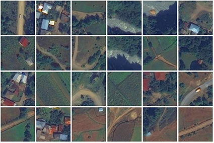
A couple of years or so ago, I arranged for the rendering of a huge set of tiles which together make a very high detail satellite image of Etseri, my village in Upper Svaneti. A local friend and I have been talking about adding layers of information to such an image. He is mostly interested in the location of every ruined watchtower and other ancient architectural feature, of which apparently there are vastly many more than the several we see standing now.
My TCT friend, hearing that I couldn't piece together all the 20000-odd pieces of my huge mosaic, had told me that he might be able to do this. My computing and programming power simply aren't great enough, and there don't seem to be any programs (either freeware or to buy, reasonably) which can tackle so many pieces—edge to edge, with zero overlap, to boot. So I sent him a USB stick with the data on it.
The thing is, he told me, he also has a drone... which is very exciting, but shouldn't surprise me now, as these things are getting everywhere on earth rather fast now. So we might consider taking new images from his drone's eye view, in the next few weeks, instead of using my satellite image, which dates from before we bought our house and moved here four years ago. We could come up with a stitched composite image from the drone's set of photos, and this too would be a very large file. How would I feel about this?
I replied that I wasn't emotionally attached to using the tile set which I’d had rendered, though this had been time consuming and rather difficult; it's just data, and if we can use something much more up to date, why not? (Even have my wife and me smiling up and waving from the ground outside the house, now that I think of it...)
The layers that I would add include: roads, paths, hiking trails, water springs, every family's house, guest houses, field ownership, municipal sites such as schools and kindergartens, pagan holy places... and so on. These would all be on separate layers connected to the online image. Anyone could then select only the information layers which they need, and either export them to a bitmap or print them for use. It would be a fantastic resource for the village, historically and commercially, especially in this information-rich age.
There was an online announcement just today, too, that Google Earth has just updated its data-set of imagery of the whole world, with much more detail and better color. Wow. Is there no stopping us? Apparently not.
Wait, there's more: with a properly programmed drone, one can even do things like slowly zoom around an object, such as a watchtower, and compile a 3D data set from images of it, later to be 3D printed... in: metal, wood, plastic stone, chocolate, whatever!
The mind boggles. A zoomable, tourable 3D map of the whole village? (Never to replace reality, one fervently hopes, even with immersive 3D virtual reality equipment now being developed). The final answer to which watchtower is the tallest of all, after accurate measurements of them all, all 200 or so in Svaneti? They tell me that Etseri's one complete tower, the Dadeshkeliani, already holds this title, and was the model for the one in Tbilisi's open-air Ethnographic Museum near Vake Park. We could settle this question once and for all.
The future of all my lifelong sci-fi reading is here, not just on earth in general but anywhere you care to go on the planet. Welcome to it, and welcome (soon) to Etseri Interactive Online, too. See you there.
Tony Hanmer runs the “Svaneti Renaissance” Facebook group, now with over 1300 members, at
www.facebook.com/groups/SvanetiRenaissance/
He and his wife also run their own guest house in Etseri:
www.facebook.com/hanmer.house.svaneti
Tony Hanmer


